2019年1月8日火曜日

NOBO JMT 2018 (4) --- Painted Lady to Upper Basin

7/27
5時起き、Painted Lady を何度も撮す。7:00 出発、アロウヘッドレイク近くのメドウ。記憶に乏しい。ここ2年は対岸をクロスカントリーしたので、6、7年前に通って以来か。ダラーレイクから快調に下り、吊り橋 10:45。登りになると、途端にペースが落ちて進めない。Twin Lake近くの何時もの場所を目指したが、届かない。そこでその手前の水場にした。17:00テント設営。

I woke up at 5:00, took many photos of Painted Lady, started to hike at 7:00. I did not have a good memory of the meadow near Arrowhead Lake. I did cross-country along the opposite bank recent 2 years. I was absent here for 6 or 7 years. I hiked down smoothly from Dollar Lake to the suspension bridge. It was 10:45. But, I did not walk fast hereafter, because the trail went upward. I intended to go to the usual place near Twin Lakes. But it was difficult. Therefore, I pitched my tent near  Sawmill Pass Trail Junction.


Painted Lady in the morning

Arrowhead Lake

The lower stream of Arrowhead Lake


The suspension bridge

Woods Creek


near WA083B


rehydrate beef jerky


7/28
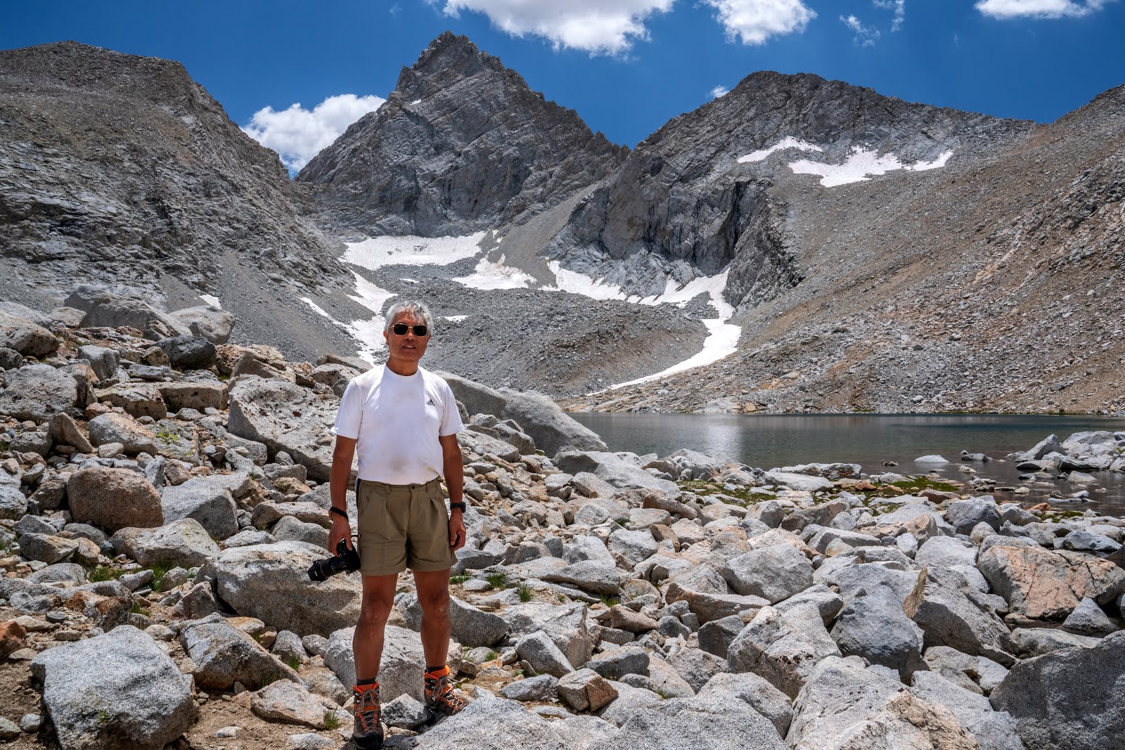
夜中に頭痛、ロキソニンを半錠飲む。5時半起き、7時出発。Pinchot Pass 10:40。Lunch。ハイカーが数名。写真を撮って貰う。サウスフォークの渡渉。14:30。今年は水量が少なく、簡単。ニュージーランドのハイカーと合う。彼らは重装備。JMTを遡り、Upper Basinにテント設営、6:00。お気に入りの場所。

I felt a slight headache in the midnight, then I took 1/2 tablet of Roxionin. It worked great. I started to hike at 7:00. I took lunch at Pinchot Pass. It was at 10:40. A few hikers chilling. I asked my photo to the one. The river crossing of South Fork was easy. It was 14:30. I met Newzealand hikers whos packs were very heavy. I pitched my tent at Upper Basin. It was at 6:00. My favorite place.

Crater Mountain

WA0806

Pinchot Pass

Pinchot Pass


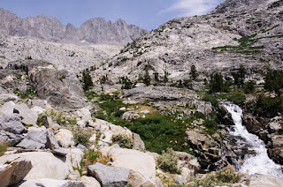
The lake below Lake Majorie,  near 0809  

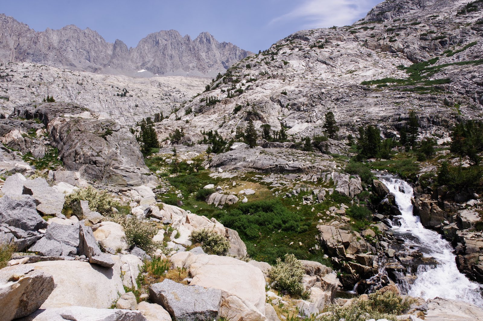
basin along South Fork 

Newzealand hikers (外国人のバックパックは重め。胸筋モリモリのお兄さんは100Lのバックパック )

Upper Basin (my favorite place )


7/29 
5:30起き、7:00出発。Rangerに追いつかれるが、頼んでもPermitをチェックしてくれない。Mather Pass 9:00、Fergason Fire (Yosemite)で少し煙っている。Upper Palisade Lake 11:30。ランチ。疲れ果てて不機嫌なオランダ人夫婦。水場を教えた。Simpson Meadow TrailのJunction の少し先でテント設営、18:00。この位置だと、明日のMuir Passは午後になる。雷雨がすこし心配。

I woke up at 5:30, started to hike at 7:00. A ranger went ahead. She did not check my permit even I asked. I arrived at Mather Pass. It was at 9:00. I felt the smoke of Fergason Fire ( Yosemite ).  I took lunch at Upper Palisade Lake. It was at 11:30. I met Dutch couple who exhausted very much and sullen. I taught the location of the water. I pitched my tent near the junction of Simpson Meadow Trail. It was at 18:00. It was too far to go beyond Muir Pass in the afternoon. I had to prepare for the thunderstorm. 

Alpine Columbine( my favorite flower )

The south side of Mather Pass

Rainger、頼んでもpermitをチェックしてくれない。胸のinReachに注目


Mather Pass

Disappointment Peak


Lower Palisade Lake


the smoke of Fergason Fire


Le Conte Canyon, near WACS0828


facebook group ---> Hiking in America

2019年1月6日日曜日

NOBO JMT 2018 (3) --- Crabtree Meadow to Painted Lady

7/24
5:30起き、ゆっくりして7:30出発、Sandy Meadowの北の峠10:00、テントを広げて乾かす。
I woke up at 5:30. relaxed, started to hike at 7:30.  I dried the tent at the pass on the north of Sandy Meadow.


Mt.Whitney

Wallace Creekで昼食。少し進んだ場所で、2時過ぎか、三人のハイカーと会って立ち話、水場を聞かれたのが切っ掛け。Shroomerの話をすると、近所に住んでいるという。中央がMichael Hofmayer, trail nameはPan Tiltということだった。左の人がセクションハイカーで、今回でJMTのスルーが完成するという。

Lunch at Wallace Creek. I met 3 hikers on the north of the creek at 14:00. A hiker asked me the water.  I talked about Shroomer, then he said he was living near Shroomer. His name was Michael Hofmayer, his trail name was Pan Tilt(center). The left guy was a section hiker of JMT, and this was his last section.


天気は下り坂。真っ平らな所で雷に遭いたくなかった。幸い、雷は大丈夫だった。
The weather was not good. I don't want to encounter thunder in the flat place. Fortunately, it did not come.

Bighorn Plateau

Tyndall Creekは水量が少なく簡単に渡れた。林の中にテント設営16:00。水を確保してテントに入ると、16:30から激しい雷雨。
The crossing of Tyndall Creek was easy because the water level was low. I pitched my tent in the forest at 16:00. I get enough water, then the heavy thunderstorm began at 16:30.

my test site near Tyndall Creek


実はイグナイターのみしか持参せず、高度の関係で着火確率が下がって困っていた。ガスを集めれば着火するはずと、漏斗状の物を取り付けた。これで確実に着火するようになった。
To tell the truth, I had only an igniter. Contrary to my expectation, it did not work well due to the altitude. But I realized that if enough gas was collected, the fire began. Then I made a small funnel which was attached to the igniter. Now it worked well.

現在は本物の漏斗を取り付けて100%の着火率。ライターは持たない。
I made this after this JMT hiking. It works efficiently. Then, I stop to have a lighter. 

7/25
4:30起き、6:00出発。昨年、Forester越えで雷雨になったので、午前中には越えたい。Pass 11:30、lunch。幸い、天気は良かった。Junction Peak直下の池でカメラを持っている重装備の人と会う。テント場はいつものBubbs Creekの場所。曇っていたが、カンカン照りになり、夕食後、木陰に引っ越した。

I woke at 4:30, starting at 6:00. I wanted to go beyond Forester Pass because I had encountered a heavy thunderstorm last summer. I reached the Pass at 11:30. Fortunately, the weather was fine. I met a guy who had a heavy DSLR camera at the small lake under Junction Peak. I pitched my tent at the usual place along Bubbs Creek. It was cloudy, but it became fine. I moved my tent under the shadow of a tree.


Upper Tyndall Creek

昨日の雪

Forester Passをバックに

Forester Pass直下

Forester Pass

Junction Peak


The photo was taken by Cam Anderson

near Bubbs Creek 0784-5


7/26
6:15出発。天気は比較的落ち着いていた。Bullfrog Trail junction 10:30、lunch. 普通の人はここで補給に下りるが、スイッチバックを登り、Charlotte Lake Trail junctionへ。 Glen Passは13:40、雷は離れた場所で、大丈夫だった。Rae Lake、15:30。 激しい雷雨が始まり、急遽、Painted Lady の正面にテント設営。もう一時間ほど歩く予定だったが、とんでもない状況。

I started to hike at 6:15. The weather was stable. I took lunch at Bullfrog Trail junction at 10:30. Many hikers went to Kearsarge Pass for resupplies. I climbed the switchbacks and arrived at Charlotte Lake Trail junction. I was at Glen Pass at 13:40. I heard the thunder at a little remote place. I arrived at Rae Lake 15:30. The heavy thunderstorm began. I immediately pitched my tent in front of the Painted Lady. I wanted to walk one more hour. but it was impossible.


Bubbs Creek in the morning

East and West Vidette


Charllotte Trail junction、昨年はここが湖になっていた。

south of Glen Pass

North of Glen Pass, Thunderstorm was approaching

The ridge of Glen Pass

in front of the Painted Lady

dinner, rehydrate beef jerky

After the heavy thunderstorm


Facebook group ---> Hiking in America

NOBO JMT 2018 (2) --- Horseshoe Meadow to Mt.Whitney

7/21 Siberian Pass Creekまで

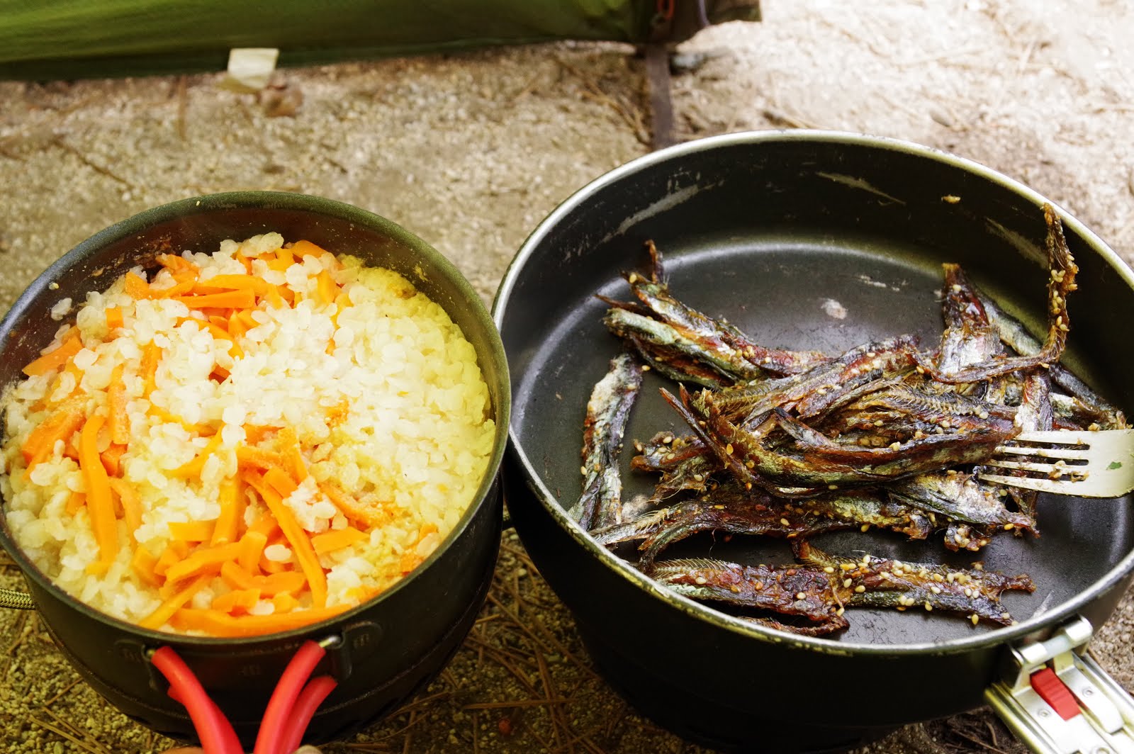
4:30起きる。軽く頭痛。高度障害。6:00出発。Cottonwood Pass 10:00、時間が早いのか人がいない。Chicken Spring 11:00、Lunch。14日分の食料を持っている(バックパックは33 kgくらい)ので、早く歩けない。14:00、水場、2016年のキャンプ地の近く。天気が悪く、雨粒が落ち始める。予定通りRock Creekへ行こうと思ったが、迷って昨年の湖でテントにしたいと思った。水を持たずに歩き、16:00、昨年の湖の跡、完全に干上がっていて焦った。どこにも水たまりなし、仕方ないのでPCT沿いにRock Creekを目指した。Rock Creekまで一時間ほどの所、西にSiberian Pass Creekがあったので、トレイルから外れてテント設営、しばらくして雷雨になった。夕食のメインはアジのみりん干し。

7/21 to Siberian Pass Creek 
I woke up at 4:30. a slight headache, due to the altitude. started at 6:00. Cottonwood Pass 10:00. no one here. Chicken Spring at11:00, Lunch. I had 14 days of food ( the total pack weight was around 33 kg), and I could not walk fast. Arrived at the small stream at 14:00, where I camped in 2016.  The weather is bad and a light rain began to fall. I should go to Rock Creek as planned, but I wanted to pitch a tent near the lake last year I had camped. I walked without water, and I found the dried-up lake at 16:00. There was only a trace of the lake, No water anywhere.  I headed for Rock Creek along PCT. But I found Siberian Pass Creek was at the west from the trail when I came to the 1-hour distance to Rock Creek. I pitched my tent quickly. Then the thunderstorm came after a while. The main dish of dinner was the dried fishes seasoned with mirin. 


Chicken Spring Lake

near Siberian Pass Creek


7/22
4:30 に起きる。ゆっくりして6:50 スタート、トレイルがなく、しばらくクロスカントリー、7:10トレイルと合流。水量が少なく、Rock Creekはlog bridgeで渡れた。Rock Creekを越えて、WA762の水場 10:30、lunch。Guyot Pass 12:00。Crabtree Meadow 14:30、天気が悪く、すぐにテント設営。15:30からもの凄い雷雨。inReachで天気をチェック。明日は11-17時は晴れるとある。もちろん、あまり当てにならない。夕食はアジのみりん干し。明日はMt.Whitneyで雷に遭う可能性が高く、夜中過ぎから出発することにした。 

Woke up at 4:30. I started slowly at 6:50. There was no trail. I did a short cross-country and joined the trail at 7:10. There was a little amount of water and I was able to go across Rock Creek on a log bridge. I crossed Rock Creek and took lunch at the watering place of WA762 10:30. Guyot Pass 12:00. Crabtree Meadow 14:30 and the weather was bad and I pitched my tent immediately. The heavy thunderstorm began at 15:30 and continued for a long time. I check the weather by inReach. It may be fine from 11:00 to 17:00.  Of course, it was unreliable. The main dish of the dinner was the dried fish seasoned with mirin. There was a high possibility of the thunderstorm afternoon near Mt.Whitney.  I decided to start to hike at past midnight. 

The log bridge of Rock Creek


Guyot Pass

Lower Crabtree Meadow, heavy thunder and rain


7/23
1:00に起きて朝食、2:30出発。珍しく、ヘッドライトで真っ暗なトレイルを進む。
I woke up 1:00, ate usual breakfast, started to hike at 2:30. The trail was in the complete darkness.


Guitar Lake を過ぎると、やっとヘッドランプが不要になった。
I passed Guitar Lake, the headlamp was no needed.

Guitar Lake

Mt.Hitchcook

from Mt.Whitney trail

At the peak of Mt.Whitney

Mt.Whineyに10:40、一応、午前中登頂の目標は果たす。写真を撮ってくれたハイカーを撮すが、名前は聞かなかった。
I climbed Mt. Whiney at 10:40. I had to reach the peak of Mt. Whitney in the morning. I took a hiker at the junction of Mt. Whitney trail, I did not hear his name. 

This guy had a good skill for a camera.  

脚が遅いこともあるが、雷の来襲が早い。2時過ぎにGuitar Lakeで雷が始まる。Timberline Lakeまで逃げるが、追いつかれる。その後は、酷い霰と雨と雷、一時、木陰に避難するが、どこにいても危険なので、先を急ぐ。17:30にテントに到着。天気が悪く真っ暗だった。
My walking speed was slow, and the approach of thunder was quick. The thunderstorm began near Guitar Lake after 2:00. I was captured by the thunder at Timberline Lake. After that, there was heavy hail, rain, and thunder. I hid under the tree for a while, but everywhere was in danger. I walked quickly in the heavy thunderstorm. I arrived at my tent site at 17:30. It was already completely dark, because of the bad weather.

Timberline Lake( Thunder was approaching)

Heavy hail and thunder


facebook group --->  Hiking in America 


2018年10月19日金曜日

Hiking in America ---postscript to the book


 二〇〇九年の夏、初めてジョン・ミューア・トレイルを歩いた。幸い、天気に恵まれたし、食料計画の失敗から少し体重を減らしただけで、スルー・ハイクは成功した。極上の夏休みだった。それに味をしめたのか、毎夏、一カ月の休暇を取って遊びに行くようになった。好奇心と偶然からPCT(パシフィック・クレスト・トレイル)のメーリングリストにも参加した。
 二〇一二年、そのメーリングリストで知り合い、一度、カリフォルニアでお世話になったシュルーマーが声をかけてきた。「この夏にカリフォルニアに来るのか。ハイシェラ以外に興味はないか。ワイオミングのウィンド・リバー・レンジ(ウィンズ)にはヨセミテより尖った岩山があるし、もの凄く奇麗な場所だ。もう一つ、グレイシャー・ナショナル・パークは大陸の王冠と言われ、アメリカで一番奇麗な場所だ。もし、興味があるなら一緒に行かないか。パイパーやトレイルハッカーにも声をかけてみるつもりだ」(2012/10/19)
 一度会っただけのアメリカ人と、一カ月、行動を共にするのは、さすがに躊躇した。しかし、シュルーマーは信用できる人間だった。と言うわけで、二〇一三年の夏、筆者はシュルーマーと行動を共にすることにした。車でサンフランシスコからワイオミングまで行き、ウィンズの南部を一週間歩いた。その後、パイパーとトレイルハッカーと合流し、カナダのウォータートンからグレイシャー南端まで二週間歩いた。グレイシャーのパーミットは厳しく、すべてのキャンプ地を予約しないと歩けない。アメリカ人でも北端から南端まで歩ける人は少ない。すべてシュルーマーのお陰である。
 筆者は運転ができないので、横で居眠りしていただけだが、シュルーマーはお喋りだった。各地の観光案内、インディアンが迫害された歴史、トレイル情報など、車の運転中に容赦なく喋りまくった。帰りはモンタナから西に進み、PCT沿いに南下してカリフォルニアに戻った。一通りの教育が終わったと考えたのか、「さあ、これでアメリカの一番良いところが分かっただろう。アメリカハイキングの本を書け」と言った。もちろん、私の答えは「バカなこと言うな。毎年、アメリカに何人ハイキングに行くと思っているんだ。無理無理」だった。
 筆者は同じ場所に何度も通う癖がある。その後、ウィンズにしばらく通った。定年退職の年は七月と八月と二カ月滞在し、アメリカの友人に呆れられた。一〇日分くらいの食料を持って出かけ、ドロドロになってホテルに帰ってきて、三日ほど滞在し、また、出かけるの繰り返しだった。まるで発情期の雄猫である。一通り、ウィンズのあちこちを探索した。シュルーマーはノース・カスケードも素晴らしいと言っていた。しかし、北海道と少し類似した風景で、ウインズより人が多いと聞いてモチベーションが下がってしまった。
 「アメリカ・ハイキング」の事は少し気になっていた。需要があるとは思えなかった。ただ、PCTを歩く日本人は少しずつ増えてきた。そろそろ頃合いかもしれない。一度、取材を受けたエイ出版の編集部に「アメリカハイキングの入門書+写真集のような本」の可能性は無いかと聞いた。すると、「ぜひやりたい」という予期しない返事が返ってきた。本の中身は真面目に考えたことはなかった。
 「まじかよ」と思ったが、マジらしいので、仕方がないから計画らしい物を作った。手元のいくつかのガイドブックを参考にして、適当な目次をでっち上げた。編集部と相談し、やっぱり執筆することになった。困った。地質学は専門用語が多くて参った。植物名の同定も厳しかった。ただ、トレイル・ガイドの項は、我ながら良く遊んだと呆れるほど、簡単に書けた。実は、都会では簡単に道に迷うが、山では一度通っただけで、ほとんどの風景を覚えている。問題は山のように写真を放り込んだため、編集が難航したことだろう。

(以下、略)

     I walked through the John Muir Trail for the first time in the summer of 2009.  Fortunately, the weather was fine and the thru-hike was a success, only reducing my body weight a little, due to the failure of a food plan. It was the best summer vacation. I repeated to visit the John Muir Trail every summer because it was comfortable, and I accidentally participated PCT-L (Pacific Crest Trail mailing list).

    In 2012, Shroomer sent an email to me, whom I knew by the mailing list and met once in California. "Are you coming to California next summer?  If you are, are you interested in hiking somewhere new?  ... the Wind River Range in Wyoming is like the Minarets on steroids!  Granite peaks and spires that are like Yosemite Valley but more pointed.  ... The other place is Glacier National Park which is known as the Crown of the Continent for a very good reason, the mountains there are simply the most beautiful in all of America.  ... I think I will be going back to one or maybe both areas ... and you would be welcome to accompany me if you are interested.  ...  I may invite Diane and Trail Hacker to Join me if they are interested. " (2012/10/19)

     I hesitated to go along with an American for a month since I met him only once. However, I know Shroomer was a reliable person. Therefore, I decided to go with him in the summer of 2013. We drove from San Francisco to Wyoming, and we hiked along the southern part of the Winds for one week. Then, we drove to the Glacier National Park and joined with Piper and Trail Hacker. We hiked for two weeks from Waterton Park of Canada to the south end of the Glacier National Park. The permit system of Glacier was strict, it needed to book all the campsite before the hiking. Therefore, a few Americans can hike through from the northernmost end to the southernmost end. All depends on  Schroomer's efforts.

    Shroomer drove all the way. I could not drive a car, sometimes slept aside to him. He was a talkative man. While driving, he continued to speak about the persecuted history of native Americans, the sightseeing guidance at every place,  and his memories of the trail, etc. We drove to west from Montana, went south along PCT, and returned to California. He thought his education was over. He said "Now, you know the best places in the United States. Write a book about hiking in America".  Of course, my answer is " It's a very silly idea.  Imagine how many people hike in America every year. It is impossible"

     I usually visit the same place repeatedly. Therefore, I visited the Winds for several years. I stayed at Pinedale for two months with July and August at the year of retirement. My  American friends were amazed at it.  I usually started to hike with 10 days food, became very dirty, returned to a hotel, stayed for 3 nights, and went out for hiking again. It is just like a male cat of the mating season. I walked around in the Winds. Shroomer had said that North Cascade was also a wonderful place. However, the scenery was similar to Hokkaido. My motivation to visit had fallen.
     I sometimes reminded about the idea of "Hiking in America". I did not think it had some demand. However, the Japanese who walk along the PCT have increased in number little by little. It may be a good timing.  I asked the possibility of "Hiking in America", which introduced  American representative trails with photographs to an editor of Ei publication. Then, I got an unexpected reply.  "Of course, we would like to publish definitely."  I had no idea about the contents of the book at that time.

   I couldn't believe it, but it might be serious. Therefore, I had to make a plan for the book.  I made some suitable contents of the book, seeing some guidebooks at hand. I met the editors at Tokyo office and decided to write.  Geology has many technical terms, and the identification of the plant name was also very difficult. However, I was able to write the guide section of the trails easily. To tell the truth, I easily got lost in a city, but I usually remember almost all the scenery in the wilderness. The problem was that I put into too many photographs in the book.

(The rest is omitted)